


trimble
ID # 17936342
Trimble WM-Drain Farm Drainage Solution

In Stock
Call for Price


Overview
Specifications
features
benefit from streamlined drainage
survey
analyze
design
map
wireless data exchange
Videos

The Trimble® WM-Drain® farm drainage solution is a concept-to-completion toolset that streamlines the survey, analysis, design, installation, and mapping steps of surface and subsurface drainage.
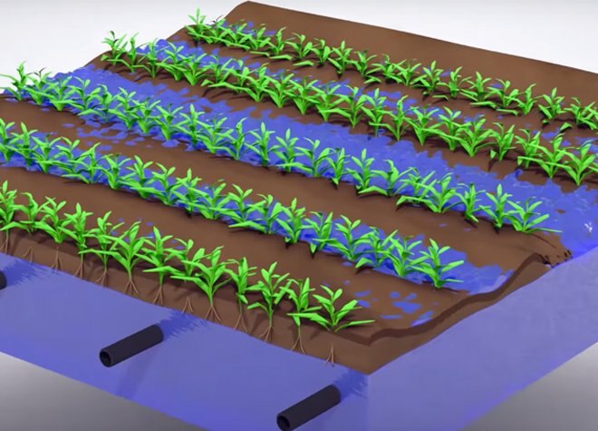
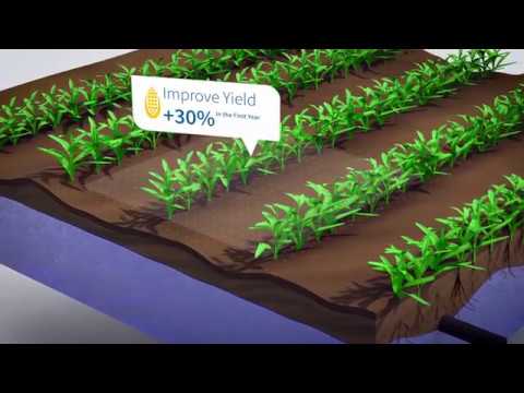
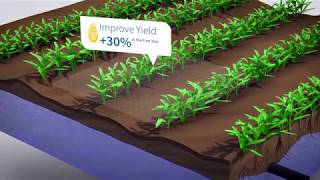
The WM-Drain solution ensures optimal 3D drain placement, which improves crop yields by controlling ponding, optimizing root depth, maximizing planting seasons, and minimizing nutrient loss.
Model
WM-Drain Farm Drainage Solution
Category Name
Agriculture
Year
2021
Sale Type
New
Manufacturer
Trimble
Features
- Seamless, integrated solution for survey, analysis, design, installation, and mapping steps of surface and subsurface drainage projects
- Software for analysis and optimal 3D drainage design
- On-the-go design capabilities
- T3™ Enhanced Terrain Compensation Technology for roll-corrected 3D positioning
- Wireless data transfer between the farm office, vehicles, and workers in the field
Benefit From Streamlined Drainage
- Complete all your drainage operations with one integrated solution
- Improve crop yields up to 30%
- Increase operating efficiency up to 20% compared to laser equipment
- Maintain a more developed root zone for better nutrient absorption
- Remove excess water from the field and lower plant stress
- Reduce field compaction and minimize soil erosion
- Use with any type of drainage plow — self-propelled, pull-type, chain, or wheel trenchers, ditches, scrapers, or any other water management implement
- Apply water to only the best producing areas within a field
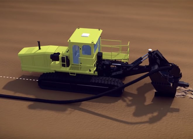
Survey
Collect 3D field data, such as boundaries and section lines, with ease.
- TMX-2050™ display – popular in-cab display can be unlocked for the WM-Drain solution at a positioning level of RTK or GLONASS for topographic mapping
- WM-Topo™ survey system – portable solution can be used separately or in conjunction with the TMX-2050 or FmX displays to collect topographic data in hard-to-reach areas such as ditches, steep terrain, muddy fields, or fields with mature crop cover
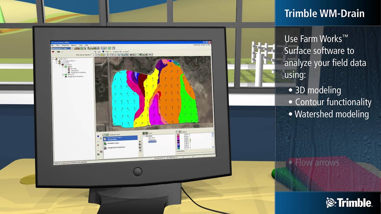
Analyze
Analyze the 3D field data using WM-Subsurface software to make better-informed drainage decisions.
- 3D modeling
- Contour functionality
- Watershed modeling
- Flow arrows
- Tributary tracking
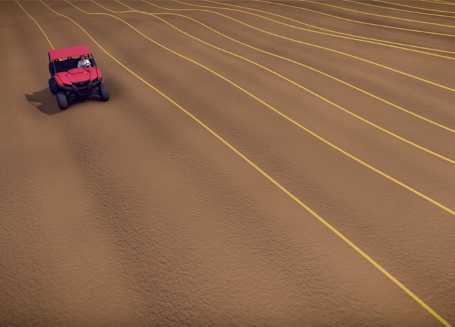
Design
Design and verify a complete 3D drainage system using Surface software or design drainage lines on-the-go without having to leave your vehicle.
- Horizontal pipe location
- Vertical design
- Automatic pipe sizing recommendations
- Verification that water will flow to the main outlet adequately
Map
Map the true location of your installed drainage pipes or ditches to utilize the records for future maintenance or drainage expansion projects.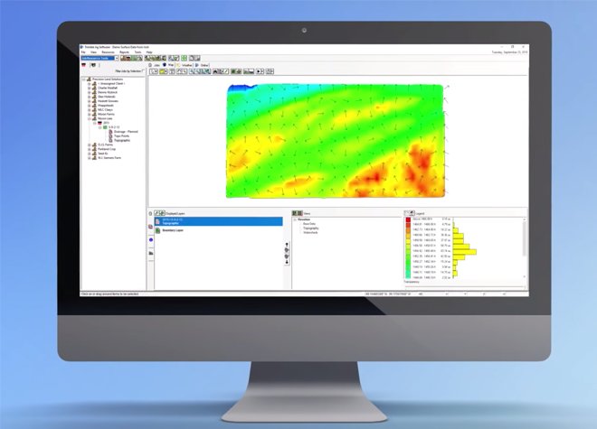
Wireless Data Exchange
With Trimble Ag Software, you can wirelessly share valuable time-saving data between your farm office, vehicles, and workers out in the field.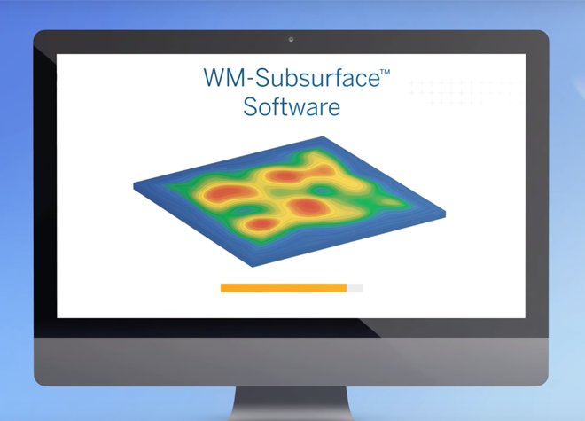
Videos

Model
WM-Drain Farm Drainage Solution
Category Name
Agriculture
Year
2021
Sale Type
New
Manufacturer
Trimble
Quantity
1


Copyright© 2026 Dealer Performance Demo - Powered by Turn Key Web Solutions - Privacy Policy - All Items - Dealer Performance Login